FORECAST HIGHLIGHTS
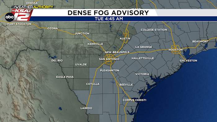
- PATCHY FOG: Like yesterday, the thickest fog will stay east of SA
- WARM PM: Temperatures will push 80° this afternoon
- RAIN CHANCES: Odds remain low, but a chance by Sunday
FORECAST
Tuesday is looking a lot like Monday. While fog shouldn’t be a huge issue in San Antonio, a Dense Fog Advisory is in effect for those east and southeast of town until 10am. Visibility could dip below a quarter of a mile in spots.
HEAT THIS AFTERNOON
Temperatures will soar later today, as sunshine will get us to near 80.

ANOTHER ROUND OF FOG, COLD FRONT AHEAD
Wednesday will give us more fog and some morning low clouds. The sun may take a little longer to pop out tomorrow. Still, it’ll be a front-arrives-this-evening-heres-a-timeline-of-what-to-expect/” title=”A strong cold front arrives this evening. Here’s a timeline of what to expect”>warm day, with highs in the upper-70s. A weak cold front will slide through by Thursday morning. This will cool us down only slightly. Highs on Thursday will be in the upper-60s. A stray shower can’t be ruled out Thursday morning.
SPRING-LIKE PATTERN THIS WEEKEND
A storm system traveling across the plains will help to send another front in our direction by Sunday into Monday. This front could be enough to create some spring-like storms for parts of Texas. As for us, our rain or storm chances are low (20%). The front is not expected to have a big impact on temperatures.

QUICK WEATHER LINKS
- WATCH LIVE: Doppler Radar
- Hourly and 10-Day Forecast
- Download FREE KSAT Weather Authority App: Up-to-date forecast information and livestreams from trusted local meteorologists.
- KSAT Connect: Share your weather photos.