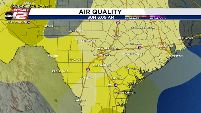
Agricultural smoke from Mexico continues to make for hazy skies.
FORECAST HIGHLIGHTS
- HEAT INDEX 100+: Yet another day of heat & humidity
- WEAK FRONT TUESDAY: Not looking as impactful as it once did
- AIR QUALITY: Smoke + humidity making for hazy skies
FORECAST
Happy Sunday! I can’t say I got a ton of good news in the forecast, but there is a window or two for rain this week and we’ll get some *slightly* cooler temperatures.
MORE OF THE SAME TODAY
We’ll begin with a bit of mornings clouds and thick humidity. As the day wears on, we’ll get sunshine. Temperatures reach the mid to upper-90s, while heat index values top out in the 101-103 range. Any isolated storms will be across the Edwards Plateau (Rocksprings to Del Rio).

WEAK FRONT TUESDAY
Monday keeps us hot and humid. On Tuesday, a weak front will approach the area. It’s going to be a close call as to just how much impact this front will have. We do expect it to limp through San Antonio, but without rain and much oomph. Slightly drier air will give us more tolerable mornings by the end of the work week.

SMALL RAIN CHANCES
We have added small rain chances Wednesday and Thursday as a weak disturbance may kick up some showers and storms. Odds, unfortunately, remain low (20%).

AIR QUALITY
Have you noticed the haze? It’s a combination of thick humidity and agricultural smoke from Mexico. It’s pretty common this time of year, but has seemed a bit more pronounced this week. Currently, air quality is in the moderate range (which is standard), but an decrease to “unhealthy for those who are sensitive” is expected Tuesday due to an increase in ozone.

QUICK WEATHER LINKS
- WATCH LIVE: Doppler Radar
- Hourly and 10-Day Forecast
- Download FREE KSAT Weather Authority App: Up-to-date forecast information and livestreams from trusted local meteorologists.
- KSAT Connect: Share your weather photos.